About
InternaSUS
The InternaSUS Project is the result of a collaboration between the InterSCity Project, based on IME-USP, and the Municipal Health Secretariat of São Paulo. Our goal is to use Computer Science advanced techniques (Big Data, Data Visualization, and Data Science) to provide innovative tools for public health professionals and managers. This is a free software project and thus open to collaborations to develop scientific advances in the area of Informatics and Big Data in Health. InterSCity is financed with funds from FAPESP, CNPq, and CAPES.
Development
The data visualization platform is free software licensed under the Mozilla Public License 2.0. It is being developed on Ruby on Rails and Javascript, using OpenStreetMap API. Its repository is available in Gitlab.
Data
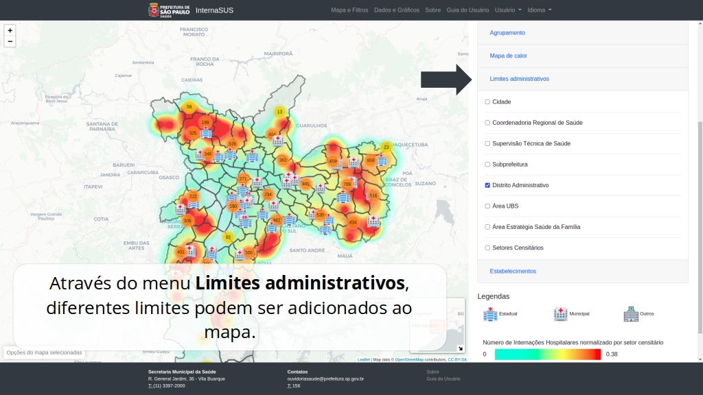
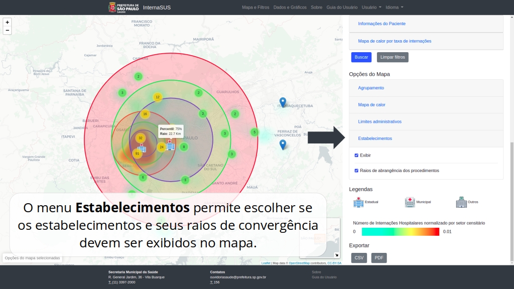
The platform presents the georeferenced data of hospitalizations funded by the Brazilian public health care system (SUS). The data is in the Hospital Information System (SIH), provided by the Municipal Health Secretariat of São Paulo. The database is anonymized, with no sensitive information about individuals and the location of households was generalized to the centroid of the corresponding census sector (territories with an average population of 600 inhabitants, in the municipality of São Paulo).
The tool also presents demographic information from the 2010 Census executed by IBGE and from populational projections made available by SEADE Foundation, stratified by sex, age group, and race/color according to territorial administrative units of São Paulo Prefecture and Municipal Health Secretariat.
Usage
Current members




Marcelo Failla
SMS/SP
Technician in the Management of Geoprocessing and Social and Environmental Information (GISA) at the São Paulo Municipal Health Secretariat (SMS).

Breno Aguiar
SMS/SP
Technician in the Management of Geoprocessing and Social and Environmental Information (GISA) at the São Paulo Municipal Health Secretariat (SMS).
Previous members
Credits
Photos: Nelson Kon
